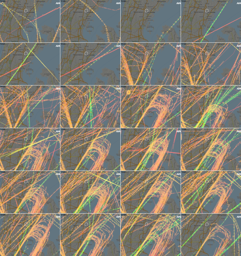
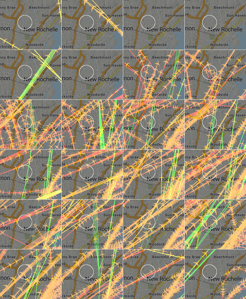
Flight patterns around Glenwood Lake neighborhood which is marked on maps with white circle.
First set of data, from Thursday 22 Oct 2022 shows dominant flight paths over GL headed NE with no turns. Based on data collected from last week of Sept through mid-Oct, this is an atypical flight pattern.
This montage is all flights per hour for 24 hours from midnight to midnight over Bronx and lower Westchester. The resolution is low to fit on the webpage. The second montage shows just the GL neighborhood at full resolution.
Kymograms show each flight path that intersects a neighborhood. The times are midnight to midnight read left to right. First image shows he neighborhoods, each one with a number in the center. This is the order the kymograms are shown top to bottom.
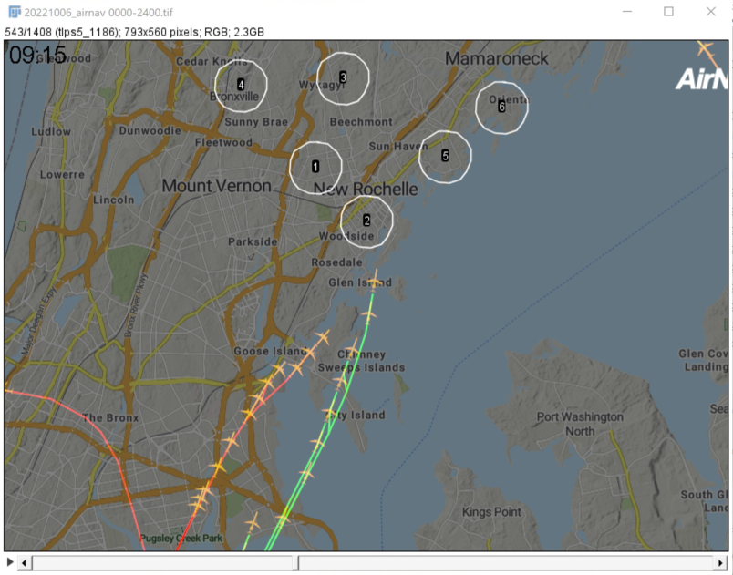

2 and 5, which are downtown New Rochelle and the Manor in Larchmont, had the most overhead traffic. A major trend is planes headed NE over Queens/Long Island which turn west to Larchmont where the turn SW counter parallel to their original heading to land at LGA. There are also planes that head SW along the coast of Westchester to joing the same path to land at LGA. Therefore, the coast receives more flights. This is consistent with other days, although the directions may be reversed.
The path over GL appears light and atypical on 6 October, but more days need to be analyzed.
The software to analyze these images is free and runs on Linux, Windows, and Mac if anyone wants to use it. All data I collected are available via portable HD or USB key. Each day's dataset is 2.4 to 3 GB depending on window size, so you need a computer with at least 8 GB of RAM.
Other files used:
ROI-around-GL-for-kymograms.roi