
This is a spot check of accuracy. Accuracy is defined as seeing a plane or hearing a plane and having it match the location data for a plane posted on the web.
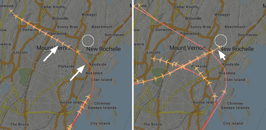
I was out front at 7:45 PM this evening (2022-09-23) when a plane flew overhead from west to east. I had the data from the websites being collected on a server at work. Later in the evening I checked the files on the server and the two datasets showed that at 7:44 a plane flew directly overhead.
The website on the left is https://webtrak.emsbk.com/panynj4 and the one on the right is https://flightradar.live/en/flight-radar/nam/us/new-york-laguardia-airport-lga-live-flight-radar/
While typing the section above, I heard a plane which sounded like it was to the west and it was quickly followed by a second plane with less obvious direction of sound. Pulling up the files from the last two minutes, this is consistent with recorded flights.
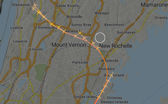
The white circle is centered on Glenwood Lake.
After a few minutes of quiet where there were no planes on the map, I again heard a rumble to the west and this corresponds.
Therefore, we have a tool to document flights in the area.
What are these images? How were they generated? The websites serve out images every second or so. I wrote a script in ImageJ to screensnap and crop out the map at five (5) second intervals. For one (1) minute the images were combined and then saved. Therefore, each image is a combination of twelve (12) frames over one (1) minute. Example code here.
This one to the west again at approx 8:55 pm seemed loud. Why the multiple lines or planes that appear to be going off to nowhere. This is because at each timepoint the software serving out the images is trying to predict the path. This path strays from the real path. And the real path, after it is completed, is also spline fitted which removes some of its accuracy. But for our purposes or counting planes at specific time over the neighborhood, this is good enough.
There may also be historical data online somewhere. This would be a lot easier to work with than screensnapping from these websites. If anyone finds these data, please email me at mcammer@gmail.com
Spot check 3 October 2022.
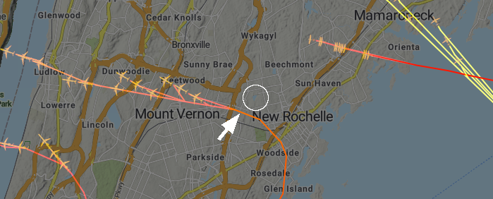
As I was walking this morning I heard a small propeller plane approaching. I looked up and there it was. My phone said it was 8:11 AM. Later, I checked the radar data being downloaded to a server. The location on the map saved at 8:11 AM is in agreement with where I was walking at that time.

While out walking the dog on 2022-10-17 three planes flew by in rapid succession headed N to S so low I fel I could reach up and almost scratch their bellies. Looking at the files, there is one image where all three paths are depicted as all three flew by in a four minutes period.
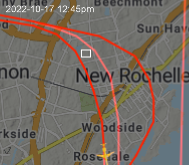
Then there was a pause of about 20 minutes before more planes flew over. A little later, a few more came in rapid succession. I snapped the picture out my back window and then pulled the radar image off the server.

This one definitely in the correct location and time.
